County:
My Location Address:
Latitude:
Longitude:
Country:
State/Province:
City:
Zip Code:
How to Find My Current County Using This Tool?
- Set the "Location Services" button to ON.
- Allow the browser to access your device’s location data.
- Your current county will be marked with a blue icon on the map.
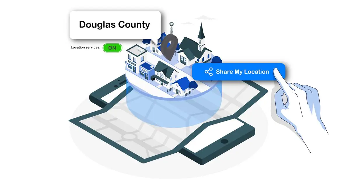
Can I Share My Current County Data?
Yes, you can share your current county data by clicking the share button. Your location data, including the county, address, latitude, longitude, country, state, city, and zip code, will be provided whether you are using a phone or desktop.
Can I Zoom In/Out on the Map to See What County I Am In?
Yes, you can zoom in or out on the map to see what county you are in. To do this:
- Click the + button on the map toolbar to zoom in.
- Click the - button on the map toolbar to zoom out.
Can I Make the Map Full Screen to See What County I Am In?
Yes, you can view the map in full screen by clicking the "View Fullscreen" button on the map toolbar.
How accurate is the county detection using this tool?
The tool uses browser geolocation, which on mobile devices with GPS can be accurate to within meters sufficient for precise county identification. On desktops or with IP fallback, accuracy may vary to neighborhood level, but it's generally reliable for county boundaries in most populated areas.
Does the tool work outside the United States?
While primarily designed for U.S. counties, it functions globally by detecting administrative divisions (equivalent to counties, such as districts or provinces in other countries). However, the "County" field may display local equivalents or remain blank in regions without direct county systems.
Is my location data private when using this tool?
Yes, the tool processes geolocation entirely in your browser—no data is sent to or stored on the server beyond temporary map requests. Your privacy is maintained as the site doesn't track or log visits long-term.
Does the Tool Work Offline?
No, the tool requires an active internet connection to load map data and access geolocation services. However, once the location is detected, some devices may cache the map briefly for smoother navigation.
Is There a History of Previous Locations?
No, the tool does not store past locations. Each session only shows your current county, ensuring privacy and avoiding long-term tracking.
What devices support this tool best?
It works on all modern devices, but mobile phones and tablets with GPS offer the highest accuracy. Desktops rely more on Wi-Fi or IP, which can be less precise near borders.
Can I manually search for a county by entering an address?
No. The primary feature uses current location, but you can zoom and pan the map or use related site tools for address-based lookups if needed.
Are there any costs or ads interrupting the tool?
The tool is free with no registration, though the site may have non-intrusive ads; performance is smooth on most connections.
What if I'm traveling across county lines?
Frequent updates occur as you move—refresh or keep the page open for real-time county changes, helpful for drivers or hikers monitoring jurisdictions.
Can I use this tool without enabling location services?
No, the tool requires location services to be enabled for accurate results. It primarily works based on the GPS of your device (or Wi-Fi/cell tower data when permitted by your browser), which provides precise coordinates to determine your current county. Without granting location access, the tool cannot detect your position reliably and will not display your county, address, or mark your location on the map.
Why does the tool sometimes show "Nothing found" for my county?
This can happen if location permission is not granted, GPS signal is weak (e.g., indoors or in areas with poor coverage), or near county borders where boundary data is ambiguous. Refresh the page after moving to an open area or re-enabling permissions for better detection.
How can I improve accuracy if I'm near a county border?
Zoom in closely on the map after your location is marked with the blue icon. County boundaries are often visible as overlaid lines, allowing you to visually confirm which side (and thus which county) your position falls into.
Practical Usage of the "What County Am I In" Tool
Travel and Outdoor Activities
Long-distance drivers, cyclists, and hikers crossing county lines benefit from real-time county verification. Sales representatives or delivery drivers logging routes can document stops by county for expense reports or compliance. Outdoor enthusiasts planning activities like fishing or hunting often need county-specific permits or regulations; the tool helps confirm jurisdiction before heading out. In unfamiliar states, it prevents confusion when local rules vary significantly between neighboring counties.
Daily Coordination and Local Services
For everyday tasks like scheduling deliveries, ordering services, or signing up for local programs, county details matter. Many utilities, waste management, or community services operate at the county level. Parents coordinating pickups near county borders can avoid mix-ups by confirming the exact location. The tool’s quick access to county, city, and zip code makes it ideal for field workers or anyone frequently on the move needing reliable administrative boundaries.
Educational, Research, and Community Applications
Students, teachers, and researchers can use the tool to study geography, demographics, or environmental data. It helps validate county-based statistics for academic projects or field research. Local historians and genealogists can confirm locations of historical events or family records, while hobbyists such as birdwatchers or wildlife enthusiasts can log sightings accurately by county.
Recreational and Hobby Uses
Hikers, photographers, or drone operators can check county boundaries to ensure they are following local rules. Fishing and hunting enthusiasts can confirm permitted zones, and amateur explorers can document activities or collect regional data for clubs or online communities.