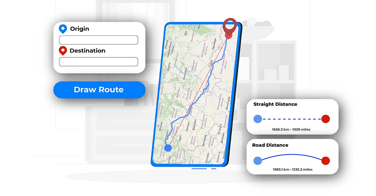
What Does the Distance calculator on onlinecompass.net Do?
The distance calculator on onlinecompass.net is a free, easy-to-use, and user-friendly tool designed to calculate distances between any two locations worldwide. Whether you're measuring the distance between two cities, towns, villages, or even precise street addresses, this tool provides accurate results in both kilometers (km) and miles (mi).
It calculates two types of distances:
- The real-world travel distance, which follows roads and pathways.
- The straight-line distance, also known as "as-the-crow-flies."
You can input locations in three flexible ways:
- By typing the name of a place, such as a city, town, or airport.
- By entering two full addresses.
- Or by providing geographical coordinates (latitude and longitude in decimal degrees) for highly precise distance measurements.

How to Use this Distance calculator?
To use the distance calculator, you can choose between two modes depending on your preferred input method:
- Search Mode
- Type the origin and destination into the input boxes.
- The tool will search locations as you type. Choose the correct suggestion for both points.
- Once both points are selected, click on “Draw Route.”
- The map will display:
- The real travel path between the two points.
- The straight-line connection between them.
- The calculated distances will be shown both in kilometers and miles.
- Coordinate Mode (Latitude & Longitude)
- If you prefer precision, you can manually enter the latitude and longitude of both the origin and destination in decimal degrees.
- After entering the coordinates, click on “Draw Route.”
- The tool will then show:
- The exact travel route and direct line on the map.
- The corresponding distances in both kilometers and miles.
This method is especially useful when you're working with specific points that don’t have names or addresses, such as remote locations or GPS-based data.
Map Visualization
When you draw a route on the map, the tool distinguishes between the two types of distances visually:
- The actual travel route is shown with a solid blue line.
- The straight-line distance is shown using a red dashed line.
This helps you quickly understand both the practical and theoretical distances between your two selected points.
Clearing the Map and Setting New Points
To start over with a new origin and destination:
- Click the “Clear All” button.
- This will remove any previously entered locations and erase the drawn routes from the map.
Keep in mind that for the distance calculation to work, both an origin and destination must be set. If you try to draw a route without selecting both, the tool will display a warning message reminding you to complete the required inputs.
What Does the "Route Guide" Section Do?
The Route Guide section provides a detailed breakdown of the actual route from your selected starting point to your destination. It outlines the path you would need to take, giving you a better understanding of how the journey would unfold in real-world terms.
Practical Uses for this Distance Calculator Tool:
The Distance Calculator on onlinecompass.net is a simple yet powerful tool that can be applied in many real-world scenarios. Since it provides accurate distances in kilometers and miles, here are some practical ways to use it:
- Travel Planning
- Calculate the distance between cities or towns to estimate travel duration and fuel usage.
- Compare actual travel distance to straight-line distance when planning the most efficient routes.
- Logistics and Delivery
- Measure the distance between warehouses, distribution centers, and customer addresses.
- Plan delivery routes and understand how far your goods need to travel.
- Real Estate and Relocation
- Check how far a property is from schools, workplaces, airports, or city centers.
- Compare commute distances when considering a move.
- Outdoor Activities and Trip Planning
- Plan walking, biking, or driving trips by knowing the exact distance between two points.
- Assess how far remote locations are from access points or nearby towns.
- Educational and Geographic Studies
- Use in geography classes to measure distances between landmarks or global cities.
- Help students understand spatial relationships using real-world distance data.
- Event Coordination
- Measure how far guests will need to travel to reach an event venue.
- Plan events in central locations by comparing distances from different starting points.
- Emergency and Safety Planning
- Determine the distance from remote areas to emergency services or evacuation points.
- Plan access routes during natural disasters or other emergencies.