What are GPS coordinates?
GPS coordinates are a precise numerical representation of a geographic location on Earth's surface, typically
expressed as latitude and longitude values derived from the World Geodetic System 1984 (WGS 84). This system
utilizes a complex network of satellites, ground stations, and receivers based on principles of geodesy and
celestial mechanics to enable accurate global positioning and navigation.
What does the GPS coordinates tool on onlinecompass.net provide?
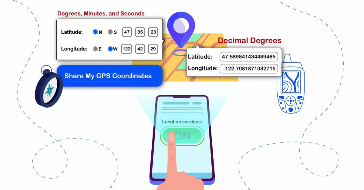
When you use the GPS coordinates tool on onlinecompass.net, it provides you with your latitude and longitude
values in both Decimal Degrees (DD) and Degrees, Minutes, and Seconds (DMS). You can also write your latitude
and longitude values and get your address on the map.
What is the DMS (Degrees, Minutes, and Seconds) format in GPS?
Degrees, Minutes, and Seconds (DMS) in GPS is a format used for expressing geographic coordinates (latitude and
longitude). It divides each degree into 60 minutes and each minute into 60 seconds, using the sexagesimal
system.
The sexagesimal system is an ancient numeral system based on the number 60, which was historically used by the
ancient Sumerians and has been adopted for dividing angles and geographic coordinates.
What is the DMS format for GPS?
Decimal Degrees (DD) in GPS is a simplified format compared to DMS to express geographic coordinates (latitude
and longitude) as decimal numbers, based on the scientific method of geodetic coordinate
systems. This method represents locations on the Earth's surface using a continuous numerical
scale, which simplifies calculations and data processing compared to traditional formats like Degrees, Minutes,
and Seconds (DMS).
How to use the GPS coordinates tool on onlinecompass.net?
To use the GPS coordinates tool on onlinecompass.net, first set “Location Services” to the ON mode.
This will display the GPS coordinates of your current location in both Decimal Degrees (DD) and Degrees,
Minutes, and Seconds (DMS) formats.
You can also enter latitude and longitude in either DD or DMS formats. By pressing the “Get Address”
button, the tool will display the specified location on the map.

Can I find GPS coordinates for a location other than my current location on the map?
Yes, you can find GPS coordinates for a location other than your current location. To do this:
- Click on the search icon in the top right corner of the map.
- Enter the name of the desired area (such as a city, state, or country) and select your location from the
suggested results.
- The map will then display the area you selected.
You can now click on your desired point within this new section of the map to find the GPS coordinates of that
location.
Can I share my GPS coordinates using this tool?
Yes, you can share your GPS coordinates using this tool. To do this:
- Click on the share button on the page.
- A pop-up will appear. Select the application to which you want to transfer the data.
- Latitude and longitude information, along with the location address, country, city, state/province, and zip
code, will be shared. A link to a map displaying the circles you have drawn will also be provided.
Can I zoom in/out on the map to find my GPS coordinates?
Yes, you can zoom in or out on the map to find my GPS coordinates. To do this:
- Click the + button on the map toolbar to zoom in.
- Click the - button on the map toolbar to zoom out.
Can I make the map full screen to find my GPS coordinates?
Yes, you can view the map in full screen by clicking the View Fullscreen button on the map
toolbar.
When is the GPS coordinates tool used?
- Travel Planning: When planning a trip, you can use the GPS coordinates tool to find exact
locations of tourist attractions, hotels, and restaurants. This helps in creating a detailed itinerary and
ensuring you visit all the desired spots.
- Delivery Services: For delivery drivers, GPS coordinates are crucial for pinpointing exact
drop-off locations. This helps in optimizing routes and ensuring accurate deliveries.
- Real Estate: Real estate agents use GPS coordinates to show the exact locations of
properties and nearby amenities to potential buyers, aiding in property searches and evaluations.
- Outdoor Activities: Hikers and campers use GPS coordinates to mark trails, campsites, and
landmarks, helping them navigate and ensure they stay on track.
- Emergency Situations: In emergencies, such as accidents or natural disasters, GPS
coordinates are used to provide precise locations to emergency responders, facilitating quicker and more
accurate assistance.
- Surveying and Mapping: Surveyors and cartographers use GPS coordinates to collect accurate
geographic data for creating maps and conducting land assessments.
