How to Navigate Without a Compass?
Since ancient times, ingenious travelers have honed the art of navigation by observing the heavens. Long before the invention of the magnetic compass, our ancestors relied on their knowledge of the skies to traverse oceans, cross deserts, and explore new frontiers.
This celestial wisdom lives on today, empowering modern adventurers with time-tested techniques for finding their way using the sun, moon, stars, and their own resourcefulness. Though we now enjoy high-tech navigation aids like the online compass direction finder, learning these fundamental skills connects us to the essence of exploration, tapping into the very forces that have guided humankind's urge to wander since time immemorial. As we embark on this journey into non-compass navigation, we step into the shoes of ancient mariners, nomads, and pioneers, discovering how the cosmos itself can be our guide.
Maps: The Navigator's Best Friend
Maps, oh how they've been our trusty companions on countless journeys and adventures! As time has marched on, maps have adapted and branched into various types, each catering to specific needs and interests. Let's take a delightful tour of the four main types of maps you should definitely get acquainted with:
Printed Maps:
Printed maps are good old-fashioned, physical maps made of paper or similar materials. They're like the tangible storytellers of landscapes. These maps come in all sizes, scales, and levels of detail. You can find topography, roads, landmarks, and geographic boundaries inked onto them.

Printed maps are your reliable companions for general navigation, outdoor escapades, and quick references. Whether you're hiking, traveling, planning city adventures, or just curious, they've got your back. Road maps, topographic maps for those rugged terrains, city maps, scenic trail maps, and encyclopedic atlases are classic examples of printed maps.
Digital Maps:
Digital maps are the tech-savvy cousins of traditional maps, residing in the digital realm. You can view and play with them on your gadgets, like computers, smartphones, and GPS devices.
They're the dynamic duo of mapping, allowing you to zoom in, pan around, and get real-time updates. Layers of information, from roads to satellite imagery and local hotspots, are at your fingertips.
Digital maps are your go-to for navigation, location-based services, geospatial wizardry, and planning your next epic route. GPS devices, mobile apps, and friendly web mapping services like Google Maps are their homes.
Think of your trusty Google Maps, Apple Maps, Garmin's GPS maps, and the powerful GIS (Geographic Information System) maps.
Satellite and Aerial Photographs:
These maps are like snapshots taken from space or high-flying aircraft, offering mesmerizingly detailed views of our planet.
They provide crisp, high-resolution glimpses of landscapes, revealing actual terrain, lush greenery, and human-made structures. While not your typical maps, they're visual treasures.
Satellite and aerial photographs are put to work in urban planning, environmental vigilance, disaster assessment, and land scrutiny. They're also handy for spotting real-world changes and peering into remote or hard-to-reach places.
Feast your eyes on Google Earth, Bing Maps, and specialized aerial imagery services for a breathtaking experience.
Custom Maps:
Custom maps are like the bespoke suits of cartography. They're tailor-made to match your preferences, needs, or specific goals. You can craft them yourself or enlist the help of organizations.
These maps can include layers you've personally defined, markers to highlight spots of interest, your own notes and annotations, and any other personal touches you fancy.
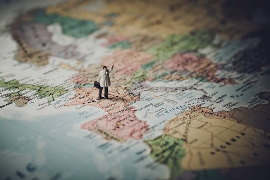
Custom maps come in handy for various tasks, from planning your dream vacation and embarking on geocaching quests to handling complex professional tasks like disaster response and facility management.
Online mapping platforms such as Mapbox and ArcGIS Online put the creative power in your hands, letting you mold maps to fit your unique requirements.
While these four map types hold a special place in our hearts, it's worth noting that technology has spurred countless innovative map applications and services, each brimming with unique features. Maps continue to evolve, transforming into powerful tools for navigation, analysis, and decision-making, ensuring that we're always one step closer to our next great adventure.
Guiding Your Way with the Celestial Symphony
When you find yourself in the great outdoors, far from modern navigation gadgets, don't worry! Mother Nature has her own GPS system in the form of celestial objects like the sun, moon, and stars. These timeless techniques are like the ancient stars themselves – always there to guide you. Let's dive into how you can use the sun, watch, moon, and stars to chart your course:
The Sun: Your Daytime Navigator
Estimating Cardinal Directions using the Sun's Shadow: This clever method helps you figure out the approximate west-east direction using the sun's trusty shadow. It's quite accurate, typically within about ±12°.

- First, grab a stick or pole (anything that stands at least 1 meter tall) and plant it firmly in the ground.
- Mark the tip of the shadow cast by your stick after waiting patiently for about 20 minutes.
- Now, let the shadow move a bit more and mark its new tip.
- Connect those two marks with a line, and voilà! You've got yourself a west-to-east line, with the first mark as your trusty west-side buddy.
Pro Tips:
- Extra Accuracy: If you want even more precision (about ±6°), do this shadow magic before noon. Mark the spot, then wait for the shadow to reach the same length again before marking the second spot and connecting the dots.
- Seasonal Sweet Spot: Around the equinoxes (that's March 21–23 and September 22–23), this method is your BFF all day long.
- Polar No-Go: Sorry, polar explorers, this method isn't your best friend. It's not suitable for regions above 60° latitude in both hemispheres.
- Time Check: Don't forget that during Daylight Saving Time, midday isn't at 12:00 but at 13:00.
- Estimating Time to Sunset: Sometimes, it's not just about finding your way; it's about knowing how much daylight you've got left for your adventure. This technique helps you estimate those precious daylight hours before sunset, no fancy timepieces needed.
- Stick both your arms out at shoulder level, palms facing you, and fingers pointing straight out.
- Align the sun so it sits at the top of one hand and the bottom of the other.
- Now, count the fingers between the sun and the horizon. Each finger represents roughly 15 minutes of daylight still left in your day. Using both hands, you can estimate up to two hours before sunset.
These celestial tricks are like secret keys to the wilderness, unlocking your power to navigate, orient yourself, and plan your journey with the wisdom of the cosmos. So, embrace the great outdoors and let the celestial symphony be your guide!
Unlocking Your Watch's Hidden Compass Powers
So, you're out in the wild, and the compass you thought would always have your back is nowhere to be found. No worries! Your trusty analogue watch can step in as your emergency compass, guiding you through the great unknown. Just remember, this method works best when you're a bit farther from the equator.
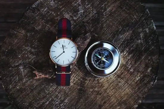
Northern Hemisphere (Finding South):
- Hour Hand Sun Salutation: First, hold your watch flat and make sure the hour hand is pointing directly at the Sun.
- Angle Bisector: Now, imagine a line slicing through the angle between the hour hand and the 12 o'clock mark on your watch. That imaginary line? It's pointing southward, my friend!
Southern Hemisphere (Finding North):
- 12 o'clock Sun Showdown: In the southern hemisphere, you'll want to hold your watch flat again, but this time, make sure the 12 o'clock mark is square with the Sun.
- Angle Bisector Encore: Just like in the Northern Hemisphere method, picture a line bisecting the angle between the 12 o'clock mark and the hour hand. That line? It's your express route to the north.
Pro Tips:
- No Hands, No Problem: If your watch is all-digital and lacks those analogue hands, grab a piece of paper and draw yourself a makeshift analogue watch with the current time. It's like having your own DIY compass.
- Location Matters: Keep in mind that this method works best when you're not too close to the equator. Near the equator, the angle between the hour hand and the 12 o'clock mark changes less throughout the day, making this trick a tad less precise.
Guiding Your Way with the Moon
Picture this: you're out in the wild, surrounded by nature's beauty, and you've got nothing but the moon to guide you. No worries, you've got this! Navigating by the moon can be your secret weapon in the wilderness.
.jpg)
- Face the Way Forward: First things first, stand in the direction you want to go, the path you've chosen. Reach out with your arm, like you're reaching for the moon itself, and hold that pose for a few seconds. This little move helps you get your bearings right, aligning yourself with the moon.
- Lower Your Arm and Step Ahead: After you've made friends with the moon for a moment, gently lower your arm and start moving forward. Keep a mental note of where you expect the moon to be in the sky.
- Rinse and Repeat: About every 10 minutes or so, it's a good idea to repeat this moon-catching technique. See, the moon is on the move, and it likes to shift around a bit in the sky. So, checking in with it now and then will keep you on the right path.
This method is all about using the moon's heavenly position to keep your sense of direction sharp when you're navigating under the night sky. It's a simple but super-effective way to stay on track when your usual navigation gadgets are taking a snooze. Just remember, it works best when the moon is out and about, not hidden by clouds or mountains. Also, having a rough idea of your cardinal directions (north, south, east, west) will make this moon dance even easier.
Navigating with the Stars: A Celestial Guide
When you're out in the wild, away from modern gadgets, the stars become your trusted companions for navigation. Let's explore how you can use the night sky, including the North Star and the Southern Cross, to find your way.
.jpg)
The North Star (Polaris): Your Northern Beacon
- Spotting Polaris: First things first, find the Big Dipper (Ursa Major), that iconic ladle-shaped star formation. It's like nature's own GPS.
- Connect the Dots: Imagine a line extending about five times the distance between the two outer stars of the Big Dipper's bowl, those are your "pointer stars." Follow that imaginary line.
- Meet Polaris: Along your imaginary line, you'll come across a bright star slightly to the right. That's Polaris, the North Star.
- Double-Check with Cassiopeia: Just to be sure, look for Cassiopeia, a constellation that forms a "W" shape opposite the Big Dipper. Polaris should align with Cassiopeia when you face it.
- True North: Raise both your arms, hands together, and point up to Polaris. Gradually lower your arms until they are parallel to the horizon. That direction is true north.
Remember, Polaris might play hide-and-seek in lower north latitudes, so when it does, Cassiopeia can help you find your way.
Calculating Magnetic Declination with Polaris
- In the northern hemisphere, you can estimate magnetic declination (the difference between magnetic north and true north) by taking a visual bearing on Polaris.
- When Polaris is visible, measure its bearing relative to your location using a compass or any other navigation tool.
- Polaris traces a circle of about 0.75° radius around the north celestial pole, so this gives you an approximate magnetic declination within a degree.
- If you're at higher latitudes, consider using a plumb-bob to sight Polaris against a reference object near the horizon for more precise results.
Estimating Latitude with Polaris
- You can also use Polaris to figure out your latitude by measuring the angle between it and the horizon.
- Extend your arm in front of you and note that the width of your flat hand, from thumb to little finger, roughly equals 10°.
- Count how many "hands" fit between the horizon and Polaris. That's a rough estimate of your latitude north.
These techniques let you tap into the North Star's wisdom for basic navigation and orientation under the night sky, making you a starry-eyed adventurer.
Navigating in the Southern Hemisphere: Finding Due South
Now, if you find yourself south of the equator where Polaris is shy, don't fret! The Southern Cross constellation comes to the rescue. Here are three methods:
Method 1: The Acrux-Achernar Line
- Locate the bright stars Acrux and Achernar within the Southern Cross constellation.
- Imagine a line connecting these two stars. Halfway along this line points to celestial south.
- To confirm due south, align one hand with Achernar and the other with the closest "pointer star" to the Southern Cross, Beta Centauri.
- Gradually bring your hands together, and they will guide you to the celestial south pole. Drop them down to the horizon, and there's due south.
Method 2: Using Achenar and Canopus
- Identify the stars Achenar and Canopus.
- Visualize an equilateral triangle with these two stars forming the base.
- The tip of this triangle points to the celestial south pole.
Method 3: Using the Upright of the Cross
- Find the Southern Cross constellation.
- Extend the upright part of the cross to the celestial south pole.
- Celestial south is where imaginary lines from Canopus and the upright of the Southern Cross intersect at a right angle.
These methods help you find due south in the southern hemisphere using the Southern Cross constellation. Plus, websites like the United States Naval Observatory provide celestial object rise/set and meridian passage times, further aiding your navigation with the stars.
In the end, mastering these celestial navigation techniques equips modern adventurers with the knowledge and skills to find their way, whether they're exploring the wild, facing emergencies, or simply embracing the art of traditional navigation.